Treasure Hunt: GIScience Club celebrates Earth Day
April 23, 2015
For Geography and Geology instructor Kevin Cary, treasure hunting is more than a pirate’s goal.
Cary and the WKU Center for Geographic Information Science (GIS) Club created their own Earth Day adventure—geocaching.
“Geocaching is basically taking something that is work related and making it fun related, and it can actually be used as an educational component,” Cary said.
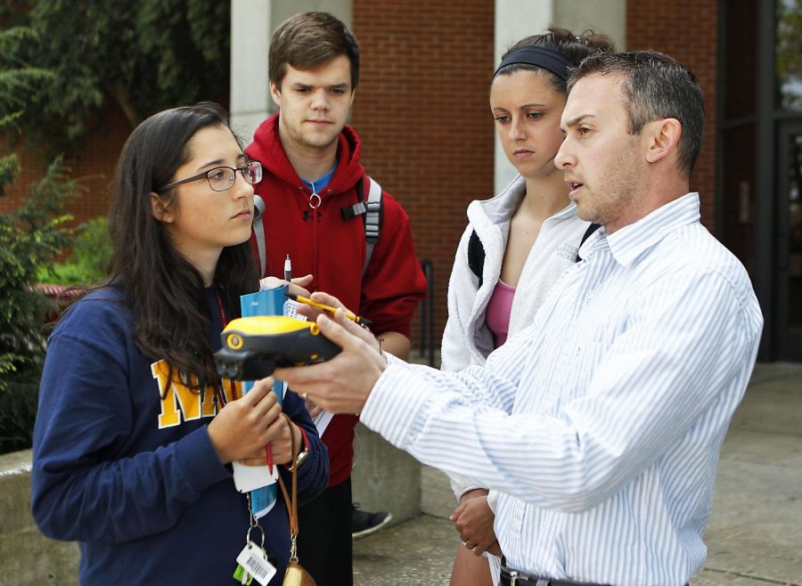
Cary explained the process involved with geocaching. He said people are given a set of coordinates, which they follow to discover an item hidden in a container—called a cache. People often take the treasure hidden inside and replace it with another item for others to discover.
Keith Koerner, Louisville senior and secretary for GIScience Club, said geocaching is more accessible now that people have access to geographic coordinates with cell phones.
Koerner said he was first introduced to it when he was fishing with his wife one day and saw people walking around with their phones, finding something and reacting as they had discovered treasure.
“It’s basically like an Easter egg hunt,” he said.
Koerner said geocaching is part of the emerging GIS field. He said there are multiple companies that have GIS departments dedicated to placing their buildings in very specific, deliberate places. He sees geocaching as part of the GIS field to be highly enjoyable.
“I don’t see how anybody can’t think that’s fun, using a $1,300 piece of equipment to find something,” Koerner said.
The event, however, was not exactly the same as regular geocaching, according to Elizabeth Goble, Battle Creek, Michigan senior and member of the GIScience club.
She said while participants still relied on GPS units, they were given a booklet with riddles that led them to different locations. Participants were awarded tickets the more riddles they answered correctly which increased their odds of winning a prize.
“We just want them to have a little bit of an appreciation for geography and GPS units and to have some fun,” Goble said.
Bowling Green freshman Andrew Gibbs participated in the event as part of an assignment for his Geography 216 class. He said he’s gone geocaching in the past and found the experience to be enjoyable. He also said geocaching is a good way to familiarize himself with the material being taught in his class.
“I guess it’s just a good way to get familiar with GIS and all of that other different stuff,” Gibbs said.
Selva Calderon, a senior from Peru, said the event was her first time geocaching. She enjoyed figuring out the riddles and navigating using the GPS apparatus. Calderon is also in the GIS minor and said she is looking towards obtaining certification in GIS. Participating in the event allowed her fieldwork and experience for her GIS studies.
“GIS takes anything that can be described with coordinates and makes a graphical representation of it, it’s pretty much like modern cartography,” Calderon said.
Cary said the Hilltopper GIScience club started in the fall of last year, so it is still relatively new. Goble said the geocaching event also served as a way to attract students to join the club.
“We want more people to get more involved in geography and mapping and to learn about what we do in the Geoscience department,” Goble said.