Alert says main campus clear; tornado watch in effect until 3 p.m.
October 26, 2010
-A tornado watch for Warren County will remain in effect until 3 p.m. CT today. A WKU alert sent at just after 11:50 a.m. CT said WKU’s “main campus should be clear” as storms move eastward.
-At about 11:35 a.m. CT, the tornado warning issued for Warren County was canceled by the National Weather Service. Classes were not canceled. A brief tornado touchdown was reported at the Corvette Plant in Bowling Green.
A severe thunderstorm warning remains in effect until noon CT.
Bowling Green Daily News photographer Joe Imel tweeted that the house reportedly damaged on Cemetary Road was already being demolished and not damaged by winds.
Click here for WBKO’s live streaming coverage.
-The National Weather Service in Louisville has issued a tornado warning for eastern Warren County until 12:11 p.m. CT. A WKU alert said to seek shelter “if needed” during a previous warning issued at around 11:10 a.m CT.
Classes have not been officially canceled. WKU Director of Media Relations Bob Skipper told WBKO at about 11:33 a.m. CT that students should “use their best judgment” when deciding whether or not to attend class.
From the NWS: AT 1122 AM CDT…THE PUBLIC REPORTED A TORNADO AT THE CORVETTE PLANT IN BOWLING GREEN EARLIER. THE POTENTIAL TORNADO IS NEAR SMITHS GROVE MOVING NORTHEAST AT 60 MPH.
A touchdown there would indicate that storms are moving out of Bowling Green, WBKO meteorlogist Chris Allen said.
From the NWS: AT 1059 AM CDT…NATIONAL WEATHER SERVICE DOPPLER RADAR INDICATED A SEVERE SQUALL LINE CAPABLE OF PRODUCING BRIEF RAIN-WRAPPED TORNADOES IN ADDITION TO WIDESPREAD STRAIGHT LINE WIND DAMAGE. THESE DANGEROUS STORMS WERE LOCATED ALONG A LINE EXTENDING FROM RICHARDSVILLE TO PETROS…MOVING NORTHEAST AT 55 MPH.
THE MAIN CIRCULATIONS ARE NEAR BARREN RIVER NORTHWEST OF BOWLING GREEN AND NEAR ROCKFIELD SOUTHWEST OF BOWLING GREEN.
-Barry Pruitt, of Bowling Green Police, told WBKO at about 11:25 a.m. that some power lines are down in Bowling Green.
-A report from WBKO meteorologist Chris Allen says a roof was blown off a house on Cemetary Road.
-At 11:01 a.m., the thunderstorm warning for Warren County was extended until 11:44 a.m. CT. Heavy rain began falling in Bowling Green shortly after 11 a.m. with little wind.
-A new tornado warning was not issued at 11 a.m. CT. A thudnerstorm warning, tornado watch and wind advisory remain in effect.
-The National Weather Service has issued a tornado warning for Warren County effective until 11 a.m. CT. A tornado watch remains in effect until 3 p.m. CT. A severe thunderstorm warning remains in effect until 11:15 a.m. CT.
-WBKO meteorologist Chris Allen said there have been very few reports of damage as of 10:30 a.m. Severe weather had yet to move into the Bowling Green area at that point.
-At about 10:15 a.m., a WKU alert was issued for “severe weather moving into BG area with tornado and thunderstorm warnings. Be prepared to seek shelter.”
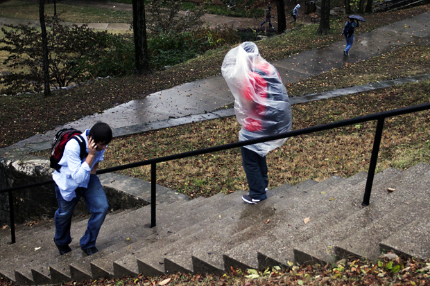
-Students have been asked to stay in the halls and basements of several buildings across campus. Hopkinsville sophomore Erica Cain called the situation weird in Cherry Hall. She said she’d rather evacuate campus at this point, but she would rather be in the hall than her women’ study class.